Canadian Dollars


have questions?
Always the correct part
We know our products
Fast & Reliable


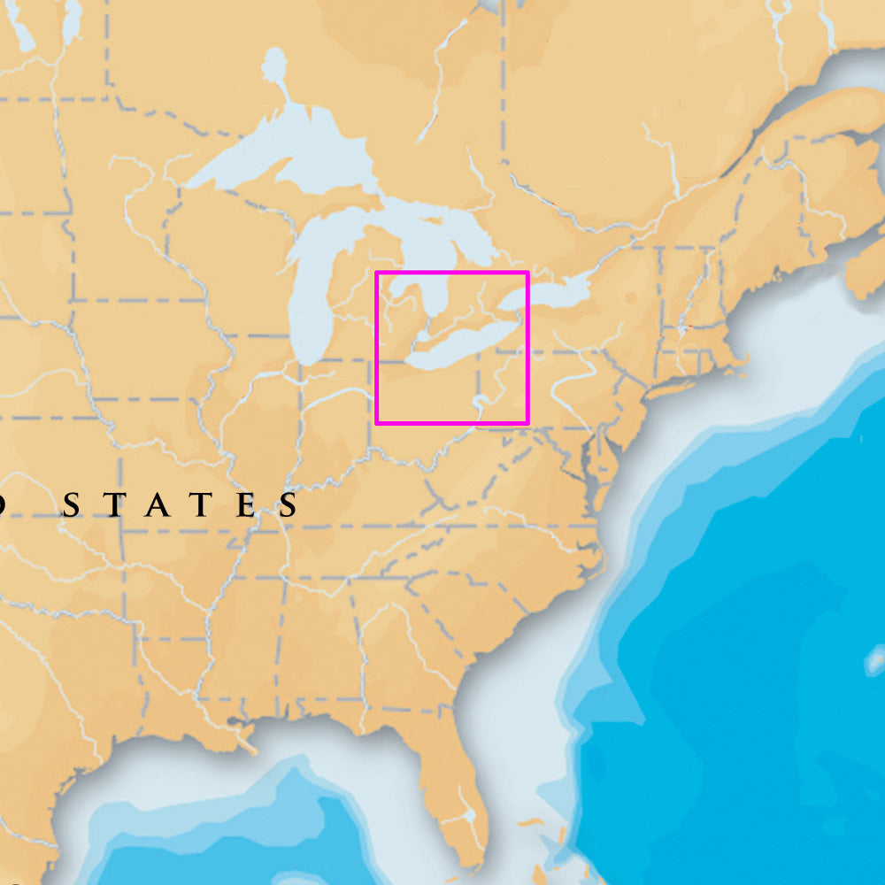
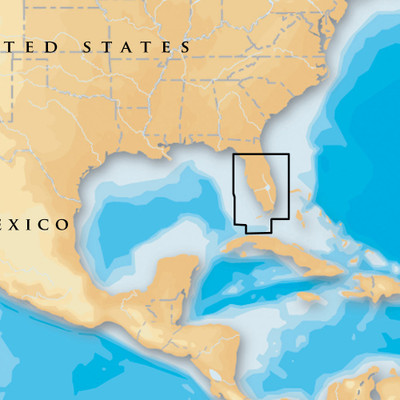
Navionics Platinum+ charts include all the content of Navionics (R)+ cartography, with integrated offshore and inland mapping, 42,000+ lakes and additional viewing options for relief shading, satellite imagery with SonarChart shading overlay, 3D perspective view, aerial photos and more.
Platinum+ - Lake Erie & Saint Clair - microSD/SD
Head out with confidence! All the same marine content and advanced features found in Navionics+ are augmented with 3D View, satellite overlay and panoramic photos to provide the ultimate situational awareness. Designed with the most demanding boaters and serious anglers in mind, these additional viewing options can be used on a growing number of GPS plotters. Quickly target the best spots and catch more fish! Daily updates and advanced features are included for one year. Simply plug your card into your PC/Mac and register online at navionics.com. USB reader provided.
| Type: | |
|---|---|
| Vendor: |
Navionics |
| Weight: |
0.3 lb |
| Card Format: |
MicroSD/SD |
| User Guide: | |
| Product Brochure: |
All returns must be authorized. Items returned prior to authorization will not be accepted. For international customers where applicable, customers must ship any returns to us freight and duty prepaid. Return freight charges for internationsl shippments will be the responsibility of the customer.
Defective new equipment may be returned for warrantyrepair/exchange to us within (5) days of the shipment receipt date. After five (5) days, returns will be handled by direct contact and in accordance with the warranty terms of the item's manufacturer. Items that have malfunctioned due to mishandling, electrical overload, etc., will be subject to repair charge.
Non defective new equipment will be authorized for return within five (5) days of the shipment receipt date if the equipment is still in new, re-sellable condition with the original manual(s), accessories, packing material and carton. We reserve the right to reject returnsin which there is no original packaging, missing accessories, damage or visible signs of usage of the item. A restocking fee of up to 25% of purchase price may apply. Special orders and dangerous goods are non-returnable.
(Do not write anytingon the manufacturer's original package or use as a shipping carton. Include all accessories, manuals and warranties.)
Please, include a copy of the packing list or invoice with a reason for the return. Your return authorization number is valid for thirty (30) days.
We can ship to both US and Canada. Note that there are restrictions on some products, and some products cannot be shipped to international destinations.
When you place an order, we will charge a flat rate shipping for your items.
Please also note that the shipping rates for many items we sell are weight-based. The weight of any such item can be found on its detail page. To reflect the policies of the shipping companies we use, all weights will be rounded up to the next full pound.
Not Applicable
| Condition: | NA |
Defective new equipment may be returned for warrantyrepair/exchange to us within (5) days of the shipment receipt date. After five (5) days, returns will be handled by direct contact and in accordance with the warranty terms of the item's manufacturer. Items that have malfunctioned due to mishandling, electrical overload, etc., will be subject to repair charge.
Non defective new equipment will be authorized for return within five (5) days of the shipment receipt date if the equipment is still in new, re-sellable condition with the original manual(s), accessories, packing material and carton. We reserve the right to reject returnsin which there is no original packaging, missing accessories, damage or visible signs of usage of the item. A restocking fee of up to 25% of purchase price may apply. Special orders and dangerous goods are non-returnable.
(Do not write anytingon the manufacturer's original package or use as a shipping carton. Include all accessories, manuals and warranties.)
Please, include a copy of the packing list or invoice with a reason for the return. Your return authorization number is valid for thirty (30) days.